


EPB: An Hibernian atlas, or, General description of the kingdom of Ireland (Digital Image Collection)
Browse by
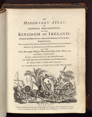
An Hibernian atlas, or, General description of the kingdom of Ireland: divided into provinces with its sub-divisions of counties, baronies, showing their boundaries, extent, soil, produce, contents, measure, members of Parliament, and number of inhabitants: also the cities, boroughs, villages, mountains, bogs, lakes, rivers and natural curiosities: together with the great and bye post roads: the whole taken from actual surveys and observations by Bernard Scale, land surveyor; and beautifully engraved on 78 copper plates by Messrs. Ellis and Palmer.
<b>Copyright 2008 The Board of Trustees, Trinity College Dublin. <br><br> Images are available for single-use academic application only. <br>Publication transmission or display is prohibited without formal written approval of Trinity College Library, Dublin. <br><br> For further copyright information or reproduction license enquiries, please contact: <br><br> Digital Resources and Imaging Services<br> Trinity College Dublin<br> College Street<br> Dublin 2, Ireland<br> +353 1 896 2888<br> digitalresources@tcd.ie<br> </b>
Recent Submissions
-
[Page 86-87]
(London: Printed for Robert Sayer, and John Bennet, 1776)An Hibernian atlas, or, General description of the kingdom of Ireland: divided into provinces with its sub-divisions of counties, baronies, showing their boundaries, extent, soil, produce, contents, measure, members of ... -
[Page 88-89]
(London: Printed for Robert Sayer, and John Bennet, 1776)An Hibernian atlas, or, General description of the kingdom of Ireland: divided into provinces with its sub-divisions of counties, baronies, showing their boundaries, extent, soil, produce, contents, measure, members of ... -
[Page 84-85]
(London: Printed for Robert Sayer, and John Bennet, 1776)An Hibernian atlas, or, General description of the kingdom of Ireland: divided into provinces with its sub-divisions of counties, baronies, showing their boundaries, extent, soil, produce, contents, measure, members of ... -
[Page 82-83]
(London: Printed for Robert Sayer, and John Bennet, 1776)An Hibernian atlas, or, General description of the kingdom of Ireland: divided into provinces with its sub-divisions of counties, baronies, showing their boundaries, extent, soil, produce, contents, measure, members of ... -
[Page 80-81]
(London: Printed for Robert Sayer, and John Bennet, 1776)An Hibernian atlas, or, General description of the kingdom of Ireland: divided into provinces with its sub-divisions of counties, baronies, showing their boundaries, extent, soil, produce, contents, measure, members of ...